Walks and paths
There are a number of walks in and around Lostwithiel to suit all ages and abilities. You can visit historic buildings, walk along ancient routes or simply enjoy the unspoilt countryside. See map showing Footpaths and Rights of Way in Lostwithiel.
Local walks
Below are links to a selection of local walks which can be printed off:
- Coulson Park and Shirehall Moor
Level, easy stroll along the river Fowey to a nature reserve, suitable for pushchairs and wheelchairs.
- Milltown Walk (3.4 miles, circular)
Some hills and country lanes in one direction, woodland and fields on the return. You can stay fairly level and traffic free if you just walk through the fields and return the same direction.
- Lanhydrock Walk (3.7 miles one way, return by train)
Level, mostly paved and traffic free through fields and woodland.
- Lostwithiel to Lerryn Walk (2 miles to St Winnow, further 2.5 miles to Lerryn)
Largely traffic free over hills to St Winnow then entirely traffic free through woodland along the Lerryn creek.
- Restormel Castle Walk (2.75 miles, circular)
Quiet country roads and fields, a steep climb to the castle gives spectacular views across the valley.
- Polscoe Loop Walk (1.8 miles, circular)
A short loop walk from the centre of Lostwithiel to Polscoe on the outskirts of the town. A short hill from Lower to Higher Polscoe.
- Duchy of Cornwall Nursery Loop Walk (2.6 miles, circular)
A circular walk up one side of the Fowey valley and back down the other, with a stop at the Duchy of Cornwall Nursery for refreshment. Some hills but not very steep. Good views of Restormel castle, Restormel Manor and down the valley towards Lostwithiel.
- Hall Walk (3 miles, circular)
The best way to see Fowey is from the opposite side of the river. This walk takes in Bodinnick, Polruan, St Wyllow church at Lanteglos, Pont creek and both ferries with a stroll back through Fowey to your starting point. Well signed and almost entirely traffic free, via woodland paths. Spectacular views across the estuary and beautiful snowdrops, wild garlic and bluebells in the Spring. Some steep climbs.
- Luxulyan Valley
Just a few miles away from Lostwithiel is a wooded valley filled with industrial remains which forms part of the UNESCO Cornwall and West Devon Mining Landscape World Heritage Site. There are numerous traffic-free paths to explore along old tramways, leats and the Treffry viaduct.
Looking for somewhere to walk your dog? Check out our dog-friendly guide to Lostwithiel.
Guided Walks around Lostwithiel by the Lostwithiel Museum Association
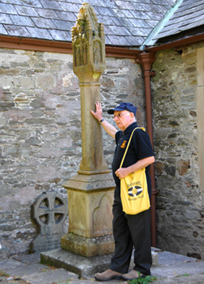
The museum organises weekly walks around town during the summer season. Further details are available on their website.
These Guided Walks which leave the Community Centre follow a route through the streets and lanes of this ancient town to trace its history from medieval times through the English civil war to the present day.
Many organisations enjoy a visit to explore the historic town and the walk can be arranged to suit the needs of groups so why not combine a visit with a wander around the interesting specialist shops and sample one of the many eateries. For details telephone 01208 873504.
Alternatively, download the PDFs for 'Places to look out for' and 'Children's challenge' to explore Lostwithiel on your own.
PDF words and images by Barbara and Ian Fraser from the Heritage Trail brochure © Lostwithiel Forum.
Walks Around Lostwithiel Book
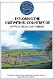 A guide called Exploring The Lostwithiel Countryside was published by Lostwithiel Museum in 2018. It is available from the museum and several shops.
It features a number of river and circular walks in and around the historic town of Lostwithiel. Written by Ronnie Puttock it is priced at £3.00
Saints' Way
The Saints' Way is a 26 mile (42 km) north to south coastal walk across Cornwall from Padstow to Fowey, which passes through Lostwithiel.
It follows the possible route that early Christian missionaries and pilgrims walked rather than risk the dangerous sea passage around Land's End, as they made their way from Ireland to mainland Europe. The route passes a number of religious sites connected with Cornish Saints and Holy Men and a wide variety of scenery including woodland, pastures moors and villages.
Find out more about the Saints' Way from the Lostwithiel Community Centre.
Longer Circular Walk
A longer circular walk around Lostwithiel including Lanlivery, Helman Tor, Maudlin and Lanhydrock. Returning via Restormel Castle.
Provided by GPS Routes. Details here. Note: This walk has not been checked by Lostwithiel Business Group.